Halfstop: A Field Atlas for Photographers
A field atlas for photographers. Scout locations, pin waypoints, and time sunrise, moonset, eclipses and aurora on maps that work with no signal.
Every good frame starts with being in the right place early.
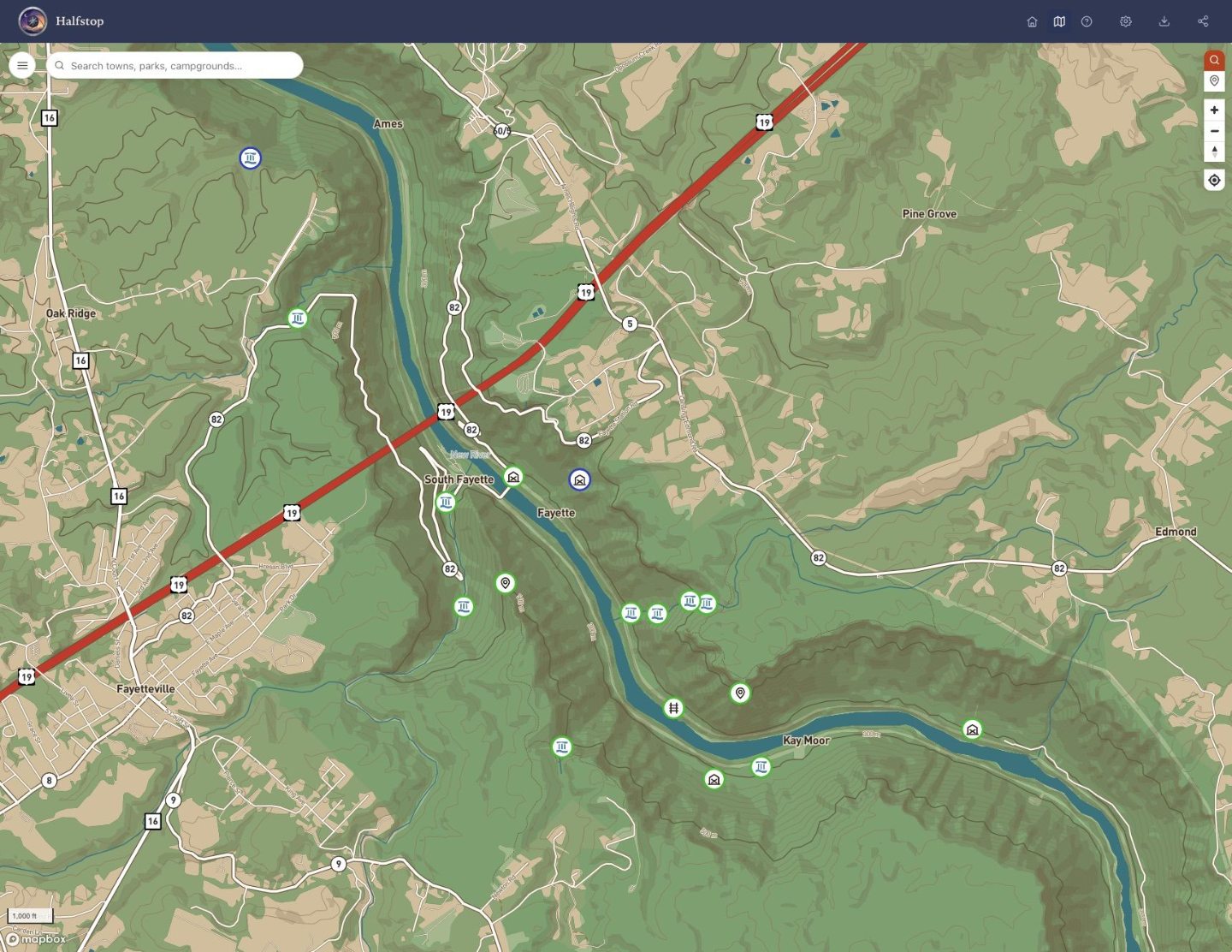
Halfstop is a field atlas for photographers. Scout a location, drop a pin, and know exactly when the sun, the moon or the aurora will be where you need them. Federal and state land, topographic and aerial layers, all downloadable before you lose signal.
How it works
Time the light, not just the drive
Sunrise, sunset, blue hour, moonrise and moonset for any pin you drop. Add eclipse tracks and aurora forecasts, and golden hour stops being a guess.
Pin it now, shoot it later
Drop a waypoint the moment you spot something worth coming back for. Sort them into folders by trip, by season, or by the light they need.
Know whose land you are standing on
National forest, BLM, state land, wilderness and park boundaries drawn on the map, with forest road numbers and drone ceilings. Find out where you can legally set up before you drive four hours to find out you cannot.
See the ground before you get there
USGS topographic quads and aerial imagery, with hillshade and contours. Read the ridge line, find the pull-off, and work out whether that overlook actually faces the direction you need.
Check the sky, not just the forecast
Cloud cover, fog, snow and storm tracks over the ground you are heading for. A clear sunrise forecast twenty miles away is not the same as a clear sunrise here.
Works where the bars do not
Download what you need before you go. The map still knows where you are at the end of a forest road two hours from a cell tower.
The light will not wait for you.
Open the map, drop a pin on the place you have been meaning to shoot, and find out when to be there.
Open the mapWhat it costs
Free to use, with a paid plan for the parts that cost money every time.
Most of Halfstop is free, and stays free: the parts that cost nothing to give away. The rest is metered. Every folder that syncs between your phone and your laptop, every region held on a server, every weather tile and every Mapbox search costs something each time somebody uses it. A free account syncs a small collection anyway; the rest is what Premium covers: $4.99 a month, or $49 a year. Subscribe on this site, or in the Android app through Google Play, and cancel whenever you like.
Free Tier
- Every basemap in the list: Byways Topo, the USGS quads, satellite and street
- Folders, waypoints, icons, colors and the table editor
- Sun, moon, blue hour, eclipse tracks
- Public land, wilderness, forest roads and drone ceilings
- Offline as a screenshot: the view saved as a picture, which costs nothing to give away
- Import and export, whenever you like: GPX, KML and GeoJSON
- Searching for a place by name, through OpenStreetMap
- Syncing up to 100 folders and 100 waypoints between your devices
Premium Tier
- Syncing any number of folders between devices
- Inviting somebody to a folder, to view it or work on it with you
- Search that also finds businesses and street addresses, through Mapbox
- Weather layers
- Offline downloads
- Trip routing
- Photographs attached to a waypoint
- State level detail maps
- Extra basemaps
There is a free month if you want one. It is something you start rather than something that starts itself, from the plan in the settings menu once you have signed in, and it needs no card — when it runs out it simply stops, with nothing to cancel. One to an account.
Nothing here needs an account, and making one is free. A free account carries up to 100 folders and 100 waypoints between your phone and your laptop; Premium carries any number, and the free month includes it. Open the map and the sign-in is in the menu.
Why those, and not others
The split is not about which features are best. It is about which ones cost money every time they are used.
Drawing the map is nearly free: the topographic mapping is one file on cheap storage, and the public land, aerial and airspace layers are served by the agencies that publish them. Sunrise, moonset and eclipse timing are arithmetic done on your own device.
Searching for a place by name is the first thing anybody does with a map, and a map you cannot search is a map you have to already know your way around. So it is free, and it comes from OpenStreetMap, through Photon, a free service komoot runs over OpenStreetMap's data. It finds towns, peaks, lakes, parks, trailheads and roads well, and businesses and street addresses less reliably. Premium search comes from Mapbox, which knows far more of both and bills for every search, which is why it is the paid one.
What this actually runs on
Four services keep it up, and all four are free at the size Halfstop is now.
Two things will not change. Getting your own data out will never be behind a payment: a folder you built is yours, and it exports as GPX with no account at all. And if a feature that is free today ever moves, it will be said here first, plainly, before it happens.